
LIDAR Service
Feel Free To Call Us
+91 767 595 6215
Aerial LiDAR, Mobile LiDAR, Terrestrial LiDAR
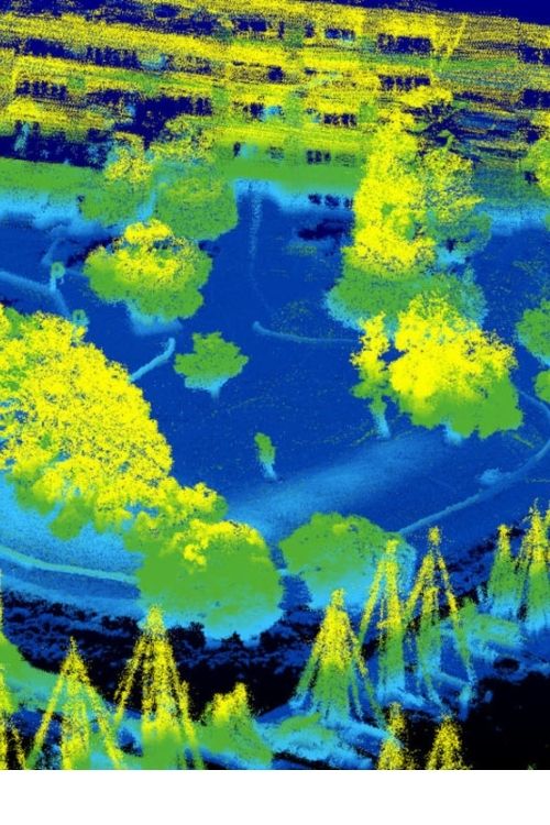
Geosis Technologies Pvt Ltd maintains a dedicated capacity to process high volumes of highly dense LiDAR data to create very accurate Digital Elevation Models (DEM), Digital Terrain Models (DTM) and Triangulated Irregular Networks (TIN) and as built structural content. LiDAR is new technology in the field of topographical data collection with high speed, high density and accurate data. Geosis Insight is the industry’s most comprehensive vegetation management analysis, Mining, Power Sector, Rail & Road Network, etc platform bring into the digital era.
geosis technologies
Our LiDAR (ALS/MLS/TLS/UAV) Services:
• LiDAR data point cloud classification & Advance classification.
• Flood Modeling/ Watershed management
• LiDAR data processing of forestry area
• LiDAR data processing of electrical utilities
• LiDAR data processing of Rail Networking & Road Transportation
• Digital Terrain Modelling / Digital Surface Modelling/ Digital Elevation Modelling
• Contour Mapping
• 3D City Modelling
• 2D, 3D Feature extraction.
Contact Us
Address
Door no 37-6-56,
MANCHUKONDA GARDENS,
MRF Tyres Road,
Satya Nagar,
MURALINAGAR,
VISAKHAPATNAM Pin: 530007
ANDHRA PRADESH
dharma.dusi@geosistechnologies.com
Phone
+91 767 595 6215
+91 950 290 1078