
Services
Feel Free To Call Us
+91 767 595 6215
Our Services
Geosis Technologies Pvt Ltd strength lies in its core of competent, Corporate Experienced, Highly qualified, trained, experienced surveyors, geoscientists, skilled computer and software professionals known to provide cutting edge technology based services.
Our ability to deliver on time with 100% accuracy has been the key to our success over the years.
Software Tools We Use
Revit is 4D building information modeling capable with tools to plan and track various stages in the building’s lifecycle, from concept to construction and later maintenance and/or demolition.
ArchiCAD is a computer-aided design and building information modeling (BIM) software from a software company called Graphisoft. The software is suited for architecture and engineering projects. You can use it to draft 2D and 3D models, architectural renderings, and technical drawings.
ReCap Photo is an Autodesk 360 service designed to create high resolution 3D data from photos to enable users to visualize and share 3D data. By leveraging the power of the cloud to process and store massive data files, users can upload images on Autodesk 360 and instantly create a 3D mesh model.
Used primarily in construction industries to complement 3D design packages (such as Autodesk Revit, AutoCAD, and MicroStation), Navisworks allows users to open and combine 3D models; navigate around them in real-time
AutoCAD is the original CAD software used by millions around the world. It can be used to create precise 2D and 3D drawings and models, as well as electrical diagrams, construction drawings, and more.
MicroStation is a CAD software platform for two- and three-dimensional design and drafting, developed and sold by Bentley Systems and used in the architectural and engineering industries. It generates 2D/3D vector graphics objects and elements and includes building information modeling features.
Inventor is computer-aided design (CAD) software developed by Autodesk, many used for 3D mechanical design, simulation and visualization. It uses the concept of parametric design, used primarily to create technical drawings for mechanical purposes.
Plant 3D is an Autodesk application targeted to the design and layout of process plant facilities. It has the tools and features designers need to create detailed plant models, including piping, structural and equipment built on the familiar AutoCAD platform.
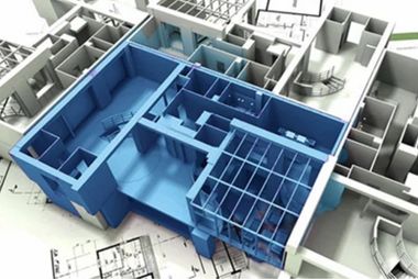
BIM
BIM has provided profound benefits to the engineering, construction and architectural industry. A revolution of sorts has changed the entire working of their projects with the initiation of BIM. A project can be envisaged, corrected, managed and spatially established before brick and mortar enter the picture. The technology successfully eliminates waste, productively uses men and materials.
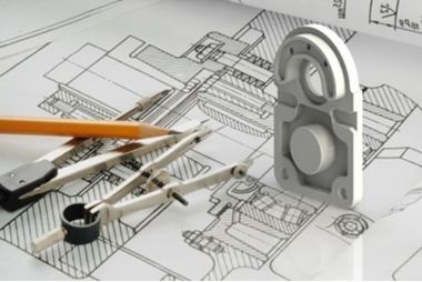
CAD
Geosis Technologies Pvt Ltd provides a full range of CAD drafting services. We have experience in CAD conversion like Raster to Vector conversions and other services like Vectorization, Dimensioning, and Conversion of prints to CAD, we bring a deep understanding of CAD drafting to the table. Our ability to deliver on time with 100% accuracy has been the key to our success over the years.
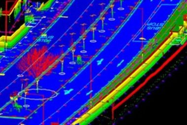
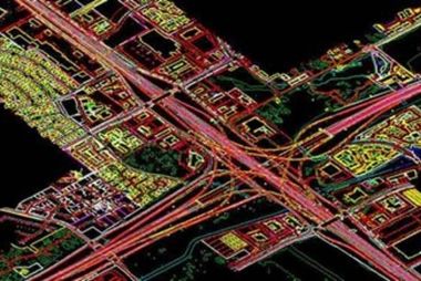
LiDar
Geosis Technologies Pvt Ltd maintains a dedicated capacity to process high volumes of highly dense LiDAR data to create very accurate Digital Elevation Models (DEM), Digital Terrain Models (DTM) and Triangulated Irregular Networks (TIN) and as built structural content. LiDAR is new technology in the field of topographical data collection with high speed, high density and accurate data.
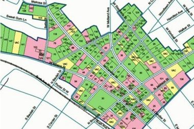
GIS
We have cutting edge knowledge of data mapping, feature extraction/compilation, management of information and integrating enterprises through GIS expertise. We have worked with various government departments and developed numerous spatial applications which are seamlessly integrated to work flow.
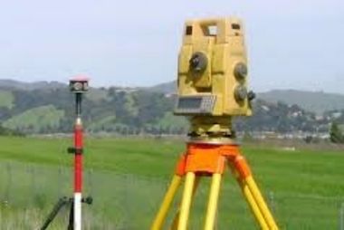
SURVEY
We have the latest and updated infrastructure for all our surveying services. For processing and analyzing the field data we use effective software tools. Geosis Technologies Pvt Ltd.’s professional and dedicated surveyors set up GPS based control stations after analyzing, designing and installing the survey monuments for land management.
Cyclone
The system is safe, ecient and costcompetitive in comparison to traditional Fixed- wing / helicopter-based data collection platforms and terrestrial survey operations. The collected imagery can be eciently processed to generate digital surface models, digital terrain model, and topography and imagery data products to integrate into both CAD and GIS systems.
Digital Photogrammetry
The high standards are maintained by using the latest digital photogrammetric technology and software. Our advanced technology and stereo plotting facility ensures; optimal quality in your georeferenced, colour balanced and seamless orthophotos
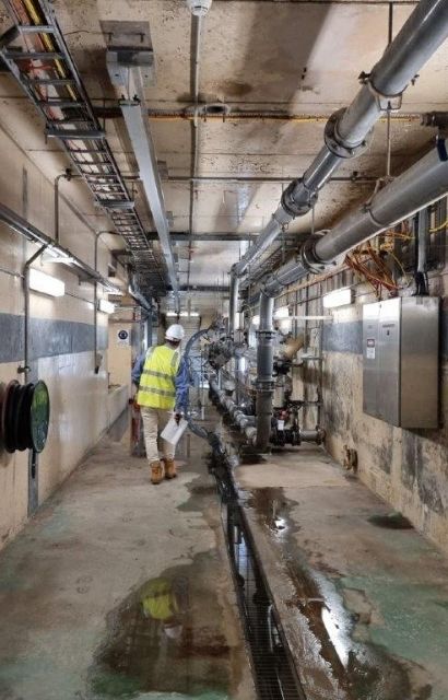
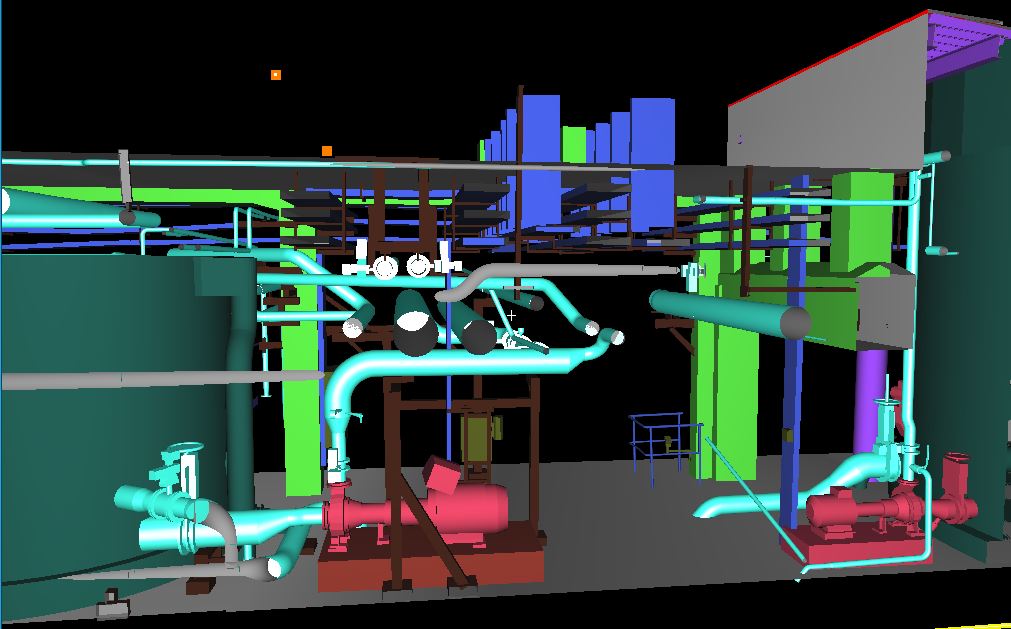
MODELLING, CLASH DETECTION, COORDINATION
Contact Us
Address
Door no 37-6-56,
MANCHUKONDA GARDENS,
MRF Tyres Road,
Satya Nagar,
MURALINAGAR,
VISAKHAPATNAM Pin: 530007
ANDHRA PRADESH
dharma.dusi@geosistechnologies.com
Phone
+91 767 595 6215
+91 950 290 1078