
Scan to 2D
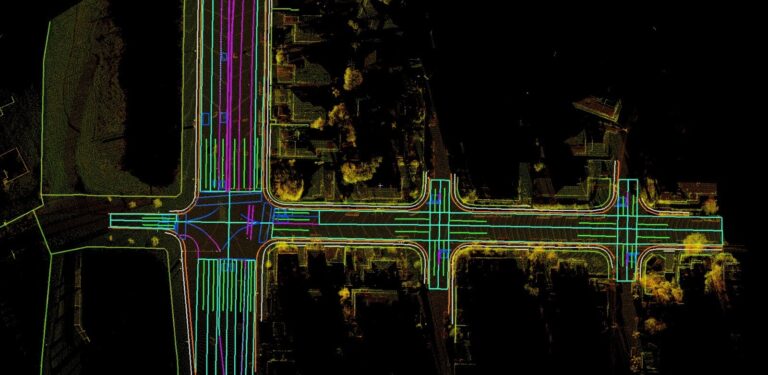
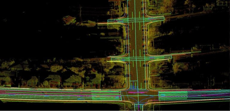
Scan to 2D is the process of converting 3D laser scan point cloud data into accurate 2D engineering drawings using software such as Leica Cyclone, AutoCAD, and other CAD tools. The point cloud captures real-world site conditions with high precision, allowing engineers and designers to create detailed floor plans, elevations, sections, and layout drawings.
This process is widely used in architecture, construction, industrial plants, telecom, oil & gas, and infrastructure projects where accurate as-built documentation is required. By extracting measurements and geometry directly from the scan data, Scan to 2D reduces manual site measurements, improves accuracy, minimizes rework, and speeds up project execution.
Process of Scan to 2D
- 3D Laser Scanning Data Collection
- Data Import and Registration
- Point Cloud Cleaning and Processing
- Quality Check and Verification
- Point Cloud Analysis
- 2D Drawing Extraction
- CAD Drafting and Detailing
- Drawing Review and Validation
- Final Documentation and Delivery
Scan to 2D is the process of converting point cloud data captured through LiDAR and 3D laser scanning into accurate 2D engineering drawings. Using software such as Leica Cyclone and AutoCAD, the scan data is registered, cleaned, and analyzed to extract detailed floor plans, elevations, sections, and as-built drawings. This process enables engineers, architects, and surveyors to accurately document existing site conditions without extensive manual measurements. Scan to 2D improves accuracy, reduces fieldwork, minimizes rework, and supports efficient planning, design, renovation, construction, and asset management by providing reliable 2D representations of real-world structures and facilities.
Get In Touch
Have a project requirement or need expert technology solutions?
Connect with Geosis Technologies Pvt Ltd today for reliable, innovative, and high-quality services tailored to your business needs.